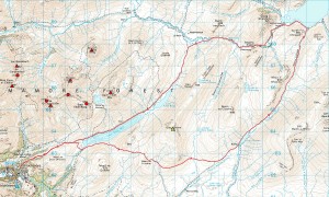
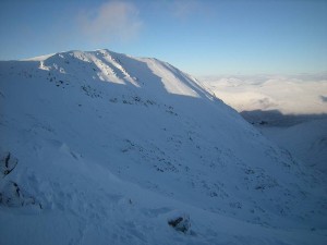
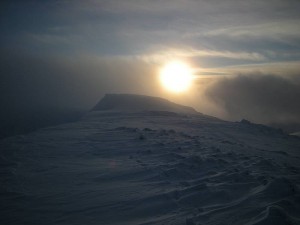
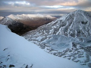
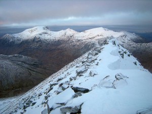
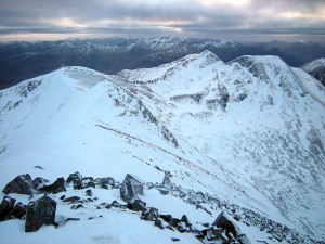
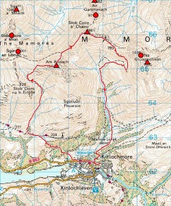
Thought my mileage was looking a bit weedy this week after missing Tuesday (brought my headache home from a late night at work!) as well as my usual Monday then turning down two climbing partners for Saturday to work on the boat with Twig (after which I managed just the 9.1 miles to the Dam and back by the Ciaran Path), so boldly set out to restore some 55-mile respectability (actually 54.7) by going for something reasonably meaty today. And this took the shape of a big loop up the brutal hill (toughest of any local trail) to An Cumhann and Loch Eilde Mor (where I met Martin and Liz Basil enjoying a walk), over the more runnable hill of Meall na Cruaidhe and through to Loch Treig by Loch Chiarain before returning by Luibeilt for a total of 22.7 miles at a modest 3,600 ft of ascent. So who knows why it felt as hard as it did in the end, but my gels and chewy bars just weren’t keeping me going and, in pushing for a >5mph average (doesn’t sound that fast but goes with the terrain), I found myself getting so dizzy coming down the final hill that I just had to blow that target (finishing with 4:34:34 ‘moving time’ from a total of 4:41:42) and take a sit-down stop to wolf down the better part of my 250g packet of apricots. And my head was spinning again by the back fence!
6 March 2011
16 January 2011
First rule of river crossings
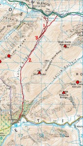
The first rule of river crossings (as any mountaineer should know) is don’t! Which is why, when running a wild, wet and windy Lairig Eilde from Glen Coe to Dalness and back yesterday, I took the pathless east side of the Allt Lairig Eilde on finding the lower ford (see map, 1) under deep running water and only regained the path (constantly visible across the torrent) where it crosses back (map, 2) more than a mile higher. Then took that upper crossing (acceptable at a calf-deep splash) on my way back with a view to staying west all the way down, which everyone (including my forgetful self!) who knows how difficult it is to get to the road from that side will recognise as a mistake. So there I was, standing just above the road looking at the camera-toting motorists on the bridge with my starting point just round the corner, but facing the probability of a three-mile detour to the top crossing and back to get there. At which point I resignedly set off back up the river hoping to find a viable crossing without retracing my steps the whole way and, after backing off from a tentative foray or two, managed to find a place about halfway up (map, 3) that would go. But still broke the first rule of river crossings (don’t) as well as my own second (never, never, never enter fast running water above knee-depth on your own) and one or two more, and know I was lucky not to bite off more than I could chew. Didn’t get knocked off my feet, but could have been. Didn’t get swept away, but could have been. Didn’t get pinned against or under that tempting tree (another no-no if you know the rules), but could have been.
So, just to reiterate the first rule of river crossings, don’t! It’s the only one you really need to know if you stick to it. And don’t think knowing that (or any of the other rules) gives you any real leeway for creative interpretation when nature has no respect for ‘experience’ in misjudgement. The crossing might seem more tempting than that detour, but better detouring than dead. Although I’d still recommend the Lairig Eilde to everyone when the rivers and burns aren’t raging because it’s quite possibly the finest short trail run in the area when you can stay with the path. :-)
PS Ran up to Penstock this afternoon (all I could face on another grotty day) and the track’s been literally torn apart by water on the Z-bends above the wee dam… worst damage I’ve ever seen to it, with a trough a couple of feet deep running down the upper bends and a strategically placed digger looking like it’s up there to do some work!
9 January 2011
Lurcher’s Crag and Kahtoola KTS Steel review
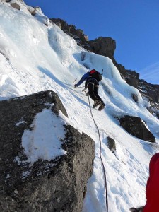
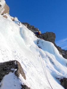
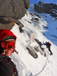
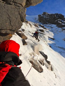
Sometimes when you want to go climbing and most of your traditional playgrounds are laden with unstable snow, it pays to think outside the box. Which is why (attracted by the prospect of carefree ice climbing on a sunny west face) Jamie B, Jay, Isi, Lorraine and I headed east on Friday to Lurcher’s Crag at the northern end of the Lairig Ghru. Now of course we weren’t the only ones to think of that, meaning that the starting pitches of the most obvious lines were already occupied by the time we got there. So Jamie and Jay joined the queue for ‘Central Gully’ (which I thought was North Gully), Isi, Lorraine and I backtracked to ‘North Gully’ (which I thought was an unnamed icefall), and we all went climbing. And our ‘gully’ was good, with an opening pitch at quite a meaty III followed by a pitch of I (if that) and another of II/III (avoidable at approx. I/II if you wanted) before turning into a walk to the top and quick diversion for me to bag the Munro Top of Creag an Leth-Choin. So the girls might tell you (in jest) that I was hogging the lead (what, with all that brittle, ‘dinner-plating’ ice?), but I swear I spent the whole climb trying to give it away! And we still weren’t sure what we’d climbed despite a positive ID (which should have put the issue beyond doubt) for the neighbouring line of The Shepherd until we belatedly discovered this wee paragraph hiding at the start of the route list in the guide:
Two fine icefalls of about Grade III standard have been climbed at the northern end of the cliff. These form in shallow gullies which can bank out under heavy snow. They are left of the following route [The Shepherd].
So we climbed one of the ‘fine icefalls’, Jamie and Jay did North Gully and a good time was had by all! With thanks to Isi for these photos (all slightly adjusted/cropped by me)…
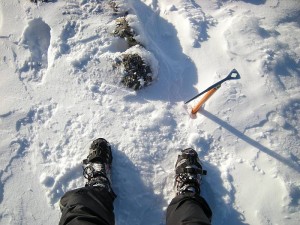
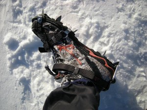
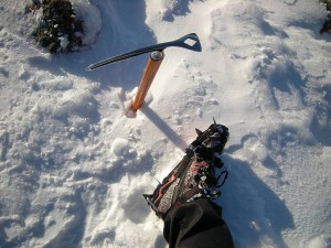
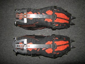
And so to the Kahtoola KTS Steel crampons, which I’ve had my eye on since last year’s running crampon review, finally ordered last week, got yesterday and took out to play on a round of the Meall a’ Bhuiridh/Creise group today. Now, while I still find MICROspikes great on ground where you can place your feet relatively flat, they’re simply not so happy when pushed on steeper gradients where you can’t. Which isn’t totally surprising when things are going to move on slopes with anything that doesn’t locate positively to the sides of the shoes, although the Canadian Hillsound Trail Crampons (which I’m also keen to try when I can get hold of some) look like stretching the elastomer harness concept a little further by grouping their spikes onto two main plates rather than splitting them into five separate pairs.
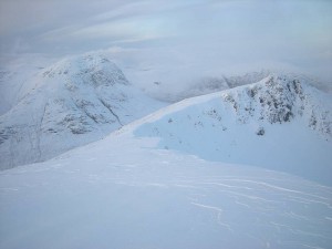
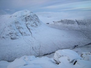
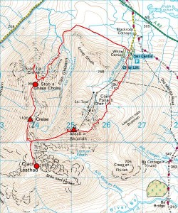
So do the KTS crampons outperform the MICROspikes on true hill ground? Well, in a word (while maybe still not perfect), yes. They’re more of a true crampon (albeit a very light 10-point design), locate properly to the sides of your shoes and don’t move about on your feet. The strap system might seem fiddly for one-off adjustment to your shoes, but looks really quite quick and simple once that’s done… although you might need (as I did) to knock out any ice getting into the quick release buckles for the ankle straps before you can clip them up and it’s probably worth hot-knifing away any excessive lengths of spare strap (plenty provided for a range of footwear types and sizes) instead of fiddling with the rubber keepers once you’re sure you’ve got enough for your chunkiest shoes. They’re obviously not front-pointing crampons for front-pointing footwear, but flat-foot well even on icy gradients (NB I still cut a few steps in the steepest places) and still really let you run while feeling considerably more secure than MICROspikes on the hill. While the toe straps and front plates stayed really secure all day (counter-intuitive tip for those used to more conventional crampons = raise your toes and pull the crampons down onto them!), I managed to knock the right heel plate sideways a couple of times on my final descent and maybe still need to experiment some more with the fitting there (guessing it must be secure enough if Lhakpa Gelu Sherpa wore Kahtoola KTS for his 10:56:46 speed climb of Everest!). And that’s pretty well all I’ve got to say about them right now, although I should just add that 1. I’ve got the anti-balling plates but purposefully didn’t fit them for my first test and 2. (re. map below) I backtracked from Sron na Creise after some prospecting of scary situations suggested I wasn’t going to find a sensible route down this steep, rocky ridge (a pleasant ascent in summer but graded ground in winter) in trail shoes with 10-point crampons.
1 January 2011
Ne’erday refreeze
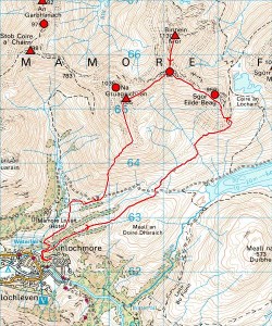
Thought I was going to write an interesting post here combining a report of today’s testing run in much crisper conditions than Thursday’s soggy snow with some updates to my year-old running crampon review. But now (still sitting here after multiple false starts) I’ve decided just to settle for a brief note that I ran Binnein Mor and Na Gruagaichean, leaving the zigzag path up Sgor Eilde Beag to cut (literally!) straight up its south ridge snowfield (where I might not have been comfortable in trail shoes and MICROspikes without that nice series of slash steps) and taking a strangely snaking route along the south ridge of Binnein Mor as the cornice swapped sides from east to west and back again. And that’s basically that, with the detailed discussion of lightweight, flexible crampon design and my thoughts on the pros and cons of the potentially more capable Kahtoola and Hillsound models I’d like to test (subject to UK distribution or private import for the Hillsounds?) held over for another time.
30 December 2010
Soggy steps on familiar hills
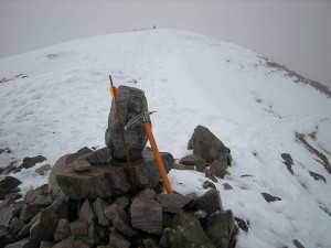
Keen to get out for some good hill days on ‘new’ ground with February’s WML Assessment looming, but lack of excitement about current thaw conditions saw me settling for a wee run over the very familiar peaks of Am Bodach and Stob Coire a’ Chairn this afternoon. Not much snow left below about 800m and even what’s still ‘covering’ the ridge mostly soft and soggy, but found some steeper/firmer patches to cut some slash steps and pigeon-holes (quite reassuring in places with ‘running’ footwear) and thought the steep NE descent of Am Bodach testing enough for trail shoes and MICROspikes in its current shape. No idea why there’s an arrow planted in the cairn of Stob Coire a’ Chairn (seems about as logical as the Sgurr Alasdair squirrel!), but left it as I found it and ran on down, finding the snow lining the Coire na Ba path just the right depth to keep trapping and tripping a runner’s lower legs. So pretty crap conditions really for hill running or practising axe work, but still good exercise and hoping the forecast refreeze means some better snow up there for some big boot work soon.
12 December 2010
Back for Meall Greigh
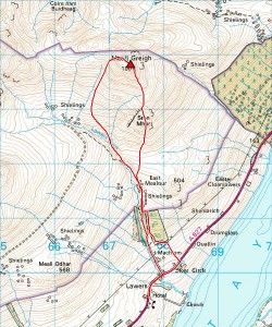
Despite waking up late enough today (on a stunning frosty morning) to consider just going for a local run, it didn’t take long to start thinking sod-that-and-get-going-because-there’s-long-enough-to-settle-that-unfinished-business-with-Meall-Greigh and head off Loch Tay way for a hit-and-run on said hill. So that’s what I did…
Nice to be able to drive straight over Ba Bridge for the first time in ages, then loads of roadside snow from Crianlarich (they must have been buried!) onwards, with cars parked at the foot of the wee hill road from Loch Tay to Bridge of Balgie and even the few metres I could see of that in passing looking like an icy non-starter. A largely snow-free ascent of Meall Greigh’s south ridge, quick confirmation (as if I needed it!) in perfect visibility that I’d all but topped out before, nice run off towards the Lawers Burn on crisp snow down to about 700m and I was back at the van a couple of hours after setting out. Oh yes, and Sealskinz waterproof socks don’t seem to be waterproof although they do still wick away moisture pretty well when wet.
Not perhaps the most complete or memorable of hill days, but still satisfying for healing a festering sore! :-)
28 November 2010
Hidden gem of the other Garbh Bheinn
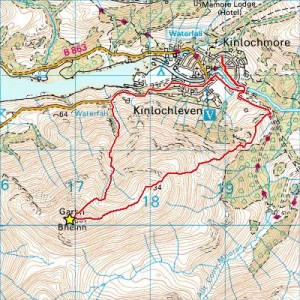
Talk about Garbh Bheinn in this area and most climbers will think of the great Ardgour rock peak despite there being another fine Corbett of that name sitting right above the village and blocking out the light! And that’s where I ran this afternoon after (wisely, from the reports coming in of folk getting stuck left, right and centre) shelving plans to go hill running elsewhere.
Took the ENE ridge (an option I can’t recall taking before) from the Penstock track, with a light covering of soft snow intermittently giving way to crustier slab and deeper driftlets and the bitter wind enough to send me scurrying down Coire an t-Sionnaich without stopping long on top. And here I took the chance to take a good look at the upper reaches of the Allt Coire an t-Sionnaich (scene of January’s true roadside ice episode), noting further climbing potential with two more major icefalls above the ‘cauldron’ and being horrified by the appearance of my right-wall ‘escape’ from this (really not soloing ground at all)! So there might be some long stretches of avoidable easy ground between the good little roadside pitches and the three bigger falls higher up (sitting in the 400/500m area and already more-or-less formed if not yet solidly enough for climbing) but, when it all freezes up, these are going to stretch an interesting little expedition (where else can you start your ice climbing from under the road?) into something rather more substantial with the best bits (thinking rope, screws and partner here!) at the top.
14 November 2010
Carn Mairg group
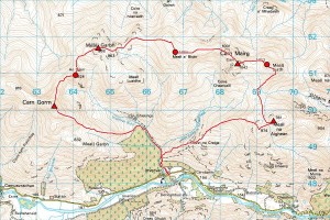
Happy to get the whole, wintry Carn Mairg group after another late-morning start from Glen Lyon (didn’t even pack my stuff till after the start of the S2S Ultra from Kinloch to Tyndrum), but might still admit to having been lured back by a fine MWIS forecast with notions of maybe (just maybe) finishing off Meall Greigh as well. However, that was never really on the agenda with cloudier/windier than expected conditions conspiring with the continuous snow cover (from about 700m) to convince me fairly quickly that this clockwise Carn Mairg circuit would be ample if I didn’t freeze before completing it!
Nothing much more to say here when I want to get the blog post done tonight, but might just explain the slight diversions before and (especially) after Meall Liath, where my self-printed (and should-have-been-laminated) A4 map finally disintegrated and I just had to get off the top for some shelter from the biting wind before digging out the full OS sheet (in map case) that I’d fortuitously packed (in my new OMM Adventure Light 20L sack) as backup before continuing on a better course.
cloudier/windier
7 November 2010
Meall Greigh wasnae there!
Yes, it rhymes (almost), or at the very least qualifies as assonance as defined in Educating Rita…
So this could have been a cheery blog post about seven Munros (five of which were new to me) snatched from a cold and windy November day on my first proper hill run since September’s rib injury, but now it’ll have to be a cheery blog post about six Munros (four of which were new to me) and one ever-so-nearly-Munro (the culprit being Meall Greigh) snatched from a cold and windy November day and all the rest of it!
Now, you might suppose that Irvine Butterfield knew what he was talking about when he described Meall Ghaordaidh as ‘quite the dullest hill in the Southern Highlands’, but Meall Greigh (being a very dull hill requiring a four-mile detour from a logical circuit of the Ben Lawers range) is possibly even duller. Especially when you miss the top and now have to go back for this hill-of-the-kind-you-swear-you’ll-only-do-once another time!
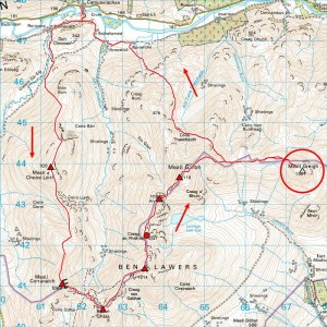
So what happened? Well, nothing that struck me as wrong at the time… it was very cold and windy and I couldn’t see more than a few metres, but the ground was dropping beyond the ‘summit’ and the altimeter said 1003 where the map said 1001 so I turned and legged it back to Glen Lyon. Then I got home, thought I’d remind myself what Butterfield and the SMC Munros guide had to say about these hills and discovered that Meall Greigh has two summit pimples separated by 200m of flat ground, with the single ring contour denoting the NW imposter neatly hidden by the ‘a’ of the hill name on the 1:50,000 map (silly, that). Knew instantly because of the way they described it that I’d goofed, so wasn’t at all surprised when importing my Forerunner track to Memory-Map confirmed the bad news and just ever so slightly took the shine off a satisfying round!
14 August 2010
Ramsay’s with Rhonda
When I wrote in my recent Ramsay’s Round report that I ‘could be persuaded to pace someone for part of the big one’ despite having ‘no intention of ever confronting Charlie Ramsay’s monster in its entirety again’, it was in the full knowledge that I might be assisting visiting US athlete Rhonda Claridge with her imminent attempt. And we got a good team together (coordinated by John Hepburn but also including Neil Arnott and Jon Gay) to do just that… along with some sociable preparatory runs (Mullach nan Coirean, Steall and Dun Deardail in various combinations) during which we fortuitously discovered the obliteration of half the path through the forest up onto the Mullach by current logging operations! Then, after postponing a day for forecast rain, the great adventure finally got under way on Thursday morning (12 August) with John and Neil taking Rhonda through the Mamores to meet me on top of Na Gruagaichean, me being charged with the task of delivering her from Binnein Mor to Fersit and Jon taking over there for the home leg. So what follows is really just some routing analysis (presented mainly in list form to match the numbers on the map) because the story’s Rhonda’s to tell, but I hope it’s not too much of spoiler to say she got round (a great effort!) but missed the magic time in slipping to 25:24 in the end…
- Met Rhonda, John and Neil on top of Na Gruagaichean about 10/15 mins ahead of schedule after wandering (dotted line) up from the village and back along the ridge from the south top of Binnein Mor.
- John and Neil left us after Binnein Mor, but (for the first time out of four this year?) we managed to follow the right path through the scree off Binnein Beag!
- Found a great line east off Sgurr Eilde Mor (where we saw a big herd of deer and I belatedly thought ‘Hillphones’!) with less contouring than the one (blue track) taken by Jon and me on our round. But it’s really ‘go anywhere’ ground here with no obvious bad choices.
- Another good, clean line off Beinn na Lap and, despite the steep climb to follow, we’d stretched our advantage to over 40 mins by Chno Dearg.
- Lost about 10 mins getting to Stob Coire Sgriodain in poor visibility (had the bearings and distances written on the map this time, but happy to compromise between compass and appropriate paths in the end) and also had a surreal encounter with a walker heading the other way with night closing in rapidly!
- Found the best line yet off Stob Coire Sgriodain, with a short gully through the outcrops high up proving the key to a mainly grassy descent when an over-zealous attempt to avoid the rougher ground encountered on our Loch Treig Round (green track) had led Jon, Gavin and me astray to the east on our round.
- Still about half an hour ‘in hand’ on meeting John, Neil and Jon at Fersit with me some 28 miles/7 Munros the worse for wear and Rhonda another 10 miles/6 Munros up on that. Thought things were clearing up (stars starting to come out) for Jon and Rhonda as we left them (NB red track changes to a dashed line where Jon took over my Forerunner), but some tricky conditions up to and through the Grey Corries apparently still lay in wait.
- Looks like a slight straightening of the line taken by the path.
- A slight diversion to the north after Jon had been discussing our route off the Easains with Bruce Poll.
- As 9 above, although not quite the northwards ‘loop’ I thought Jon was talking about.
- A better line off Stob Coire an Laoigh, apparently located by identifying a patch of red scree.
- No more GPS track with the Forerunner battery running out between Stob Coire Bhealaich and Aonach Beag.
Not sure exactly what happened after that, but (with John and Neil heading up and over the Ben yesterday morning, me waiting just above the Red Burn and Rhonda and Jon just making that final summit on the 24-hour mark), we all finished together in increasingly pleasant conditions through crowds of early-bird walkers (many already on their way down), two cyclists and one unicyclist (not actually riding at the time)! And that’s all I’m going to say just now when the rest is really Rhonda’s story, although it would be remiss not to mention that we all enjoyed a surprise meeting (+ early lunch together at Cafe Beag) with her mother and sister before going our separate ways (thanks to Neil and Morag for driving me back to Kinloch!), and naturally hope to run together again sometime. :-)


