Petestack Blog

10 April 2015

Lairig Gartain high road

Filed under: Running — admin @ 9:29 pm

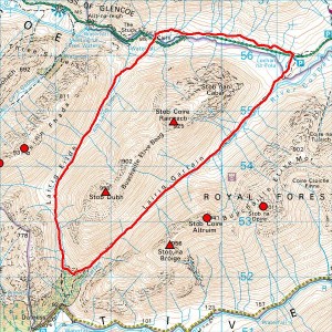
Another delightful run through the Two Lairigs today with the very belated discovery that the higher path traversing from a start up the south ridge of Stob Dubh is the one, true, sensible way up the Lairig Gartain from the south where the more awkward lower path by the Allt Gartain is more of a decoy existing mainly to spoil a good run. So take the high road, which simply traverses the flank of Stob Dubh to rejoin the lower path well below the bealach and enjoy a truly great wee run… continuously interesting, first-rate under foot till you hit the old Glencoe ‘road’ towards the end, nowhere particularly technical, but quite simply gorgeous on a sunny, spring day with snow to admire on the hills but not on the trail!

Not at home just now and can’t remember which way Susie Allison’s book said had the better views, but can’t see how you could beat the anticlockwise finish opening out the view to Stob Coire nan Lochan and the Three Sisters as you return westwards into the Glen, and would have to recommend this direction (Lairig Eilde followed by Lairig Gartain) anyway for the early chance to assess the ford at NN 182557 in ascent rather than be sucked into the very real trap of finding it impassable in descent in wetter conditions.

29 March 2015

Munros, Tops and ‘Munro-lite’

Filed under: Climbing,Running,Walking — admin @ 2:10 pm

A bit late in the day with just 12 of my 601 all-time Munro Tops left to do and Slioch waiting for 30 May but, prompted by Robin Campbell’s receipt of the Scottish Award for Excellence in Mountain Culture at last month’s Fort William Mountain Festival, I’ve finally bought and read The Munroist’s Companion. And predictably found much of interest there, not least (given the roots of my ‘purist’ approach in concerns with what’s listed in what category, or indeed at all) in David Purchase’s essay On the Classification of Mountains: a graphical approach, where he proposes well-considered objective criteria for distinguishing between Munros and Tops that would keep the list close to its current shape while removing all the obvious anomalies. So, while I’ve no time for inadequate web/media statements like ‘there are 282 mountains over 3,000ft in Scotland’ (contentious!) and still regard just the 282 (or 284, 276 or whatever it happens to be at the time) as ‘Munro-lite’, I might qualify that by suggesting that adding just Purchase’s nine remaining promotion candidates to a current ‘full-Munro-only’ round of 282 removes the worst of the ‘lite’. Do Glas Leathad Beag, the Affric Sgurr na Lapaich, Sail Mhor and Coinneach Mhor on Beinn Eighe, Stob na Doire on the big Buachaille, Cairn Lochan, Beinn Iutharn Bheag, Sgor Choinnich (Corrour Forest) and Creag Dubh (Mullardoch) and you’ve got a pretty good baseline for 291 ‘mountains’. Demote Carn Ghluasaid (which Purchase recommends but you can’t leave out so long as it’s still listed!) and you’ve got 290. All water off a duck’s back to me when I’m sticking to my 601, but surprising how little still needs changing to arrive at a decently objective list!

Might just add that I’m with Campbell on completion/compleation and expect to be completing (not compleating) on 30 May:

The use of Compleation strikes me as twee, or should be it be twea, and I have studiously avoided and expunged it in favour of completion.

His quote, my italics… very funny! :-)

22 March 2015

Slow Beinns and Lairigs

Filed under: Running — admin @ 10:41 pm

Last Sunday I fell into a pile of bricks, slabs and back wall trying to do without a ladder where I needed one but lazily thought access looked tight without moving a few bits and pieces first. Which, quite apart from serving me right by leaving me with a bashed coccyx, rather messed up my running plans by ruling out Sunday (hurt too much!), Monday and Tuesday (too busy with work, but probably still hurt too much?) to start picking up the pieces again on a fine Wednesday evening. But I’ve still managed to ‘run’ every day since without hurting myself much more beyond the occasional jarring slip, so was able to make something of the further spring-like weather this weekend on a couple of circuits beyond my typical winter evening fare…

So yesterday Marie Meldrum came down from the Fort and we had a relaxed ‘run’ (paced for my coccyx and her MTB race today) over Glas Bheinn and Beinn na Cloiche to return by the monument and Ciaran Path, narrowly missing Karl Zeiner on Glas Bheinn but later meeting Kelly, Matthew and the boys down below the German Camp.

2015-03-21map

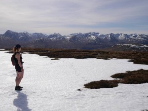
No real surprises for me from a lovely day on familiar ground except some still substantial cornices on Glas Bheinn, but how nice to see Marie (who’s not run from Kinlochleven so often) enthralled by the magic of stunning views from new territory and apparently enjoying my running (no pun!) commentary on the distant hills and nearer sights too!

2015-03-21beinnnacloiche 2015-03-21marie5

2015-03-21marie6

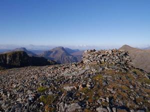
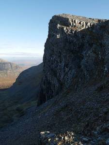
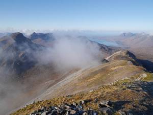
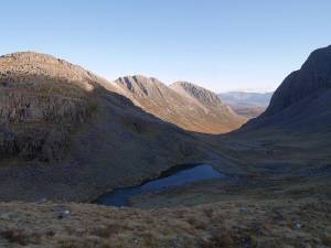
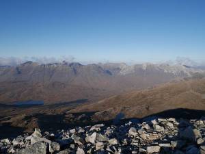
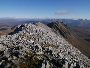
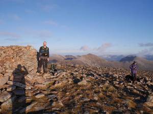
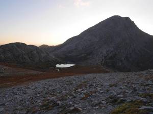
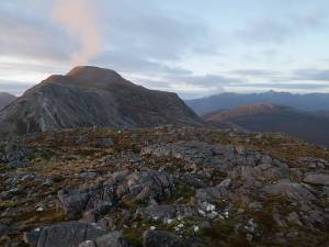
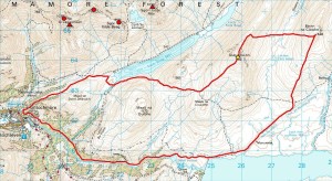
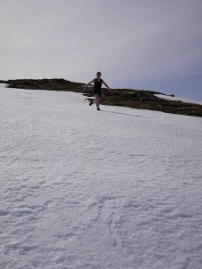
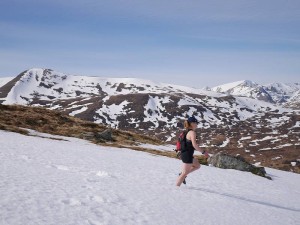
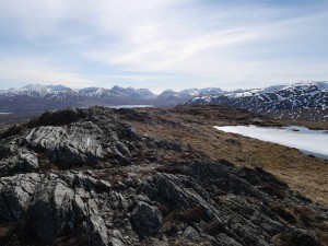
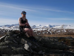
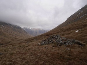
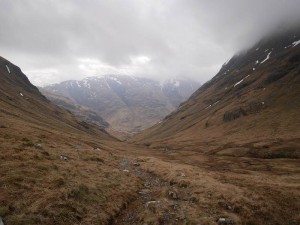
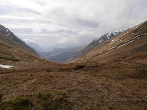
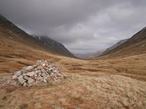
So where could I go in still somewhat injured state for a decent, but not too strenuous, follow-up today? Well, having been inspired by Marie’s enthusiasm for the classic U-shaped valley of the Lairig Gartain (visible centre background of the ‘Beinn na Cloiche’ photo), why not head down for double U-shaped fun in a repeat of the Two Lairigs? So that’s what I did, with the four ‘circuit-order’ summit photos (Lairig Eilde looking towards Glen Coe and Glen Etive followed by Lairig Gartain looking towards Glen Etive and Glen Coe) taken to show them close-up in the full expectation of being told I have to do it again soon…

2015-03-22lairigeilde1 2015-03-22lairigeilde2

2015-03-22lairiggartain1 2015-03-22lairiggartain2

2015-03-22map

13 December 2014

eTrex 20

Filed under: Climbing,Cycling,Running,Sailing,Walking — admin @ 8:36 pm

It’s not my first GPS device. I’ve got half a dozen now counting this new eTrex, two running watches (Forerunner 305 and 310XT), a nüvi 1390T for driving, a chart plotter on the boat and an old 8-channel GPS 45XL (which was my first), but most were bought for different purposes and only that old 45XL is truly superfluous now.

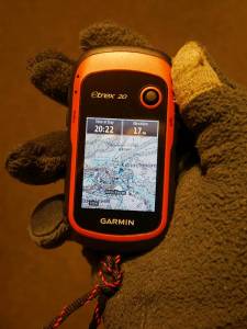
So why another GPS for the hill when map and compass works? And map and compass backed up by GPS grid refs (which I can get from the Forerunner 310XT) also works? Because map and compass backed up by mapping GPS or mapping GPS backed up by map and compass are quite simply slicker options. Until just under four years ago, I navigated the hills almost exclusively by map and (when necessary) compass. Then, after moving from a non-OS-grid-enabled GPS watch (Forerunner 305) to one that could give an OS grid ref (Forerunner 310XT), I added that to my armoury. But the 310XT’s still not primarily a navigating device, I like to keep moving in the hills (especially when dressed/equipped for running rather than walking/climbing) and find that stopping to transfer grid refs to map tends to interrupt my flow when doing so. So, just as I’ve moved from 1. just compasses, Breton plotters and paper charts for coastal navigation through 2. transferring lat and long from simple GPS to paper chart to 3. GPS chart plotter, I’ve found myself wanting a mapping GPS for the hill. And this new eTrex is light, compact, map-capable and relatively inexpensive with excellent battery life to boot. Not, retrospectively, the very ‘best’ deal on offer when I’ve since seen the likes of the GPSMAP 62s with complete GB Discoverer 1:50K (almost map + free GPS!) for what I paid for eTrex 20 and downloadable 1:50K Scotland, but then I didn’t want a GPSMAP 62s anyway (bigger, heavier) even if it might be ‘better’ in some ways!

So how does it perform? Judging from one local test run today, absolutely fine. It sits comfortably in the hand with accessible, glove-operable controls and the transreflective screen, while possibly brighter in summer conditions, is still adequately readable in December ‘daylight’. It can also be squeezed into the lower front pockets of my UD Fastpack 20 (which just wouldn’t take a beefier model), though I’m not sure they’d be my first choice storage when I’ve been using one for my keys and the other for my thumb compass so far. And I managed to fit a lanyard of decent weight (trainer shoelace) to the built-in lanyard eye though it took some considerable fiddling to get it through. My only real gripe concerns my downloadable map from Garmin at £119.99, which turns out to be tied to the device when a pre-programmed Micro SD at the same £119.99 wouldn’t be. But what’s done is done, and it’s probably a largely academic distinction when you’d lose your non-tied card anyway if you lost the device and I’ve no plans to purchase any more compatible devices in the near future…

2014-12-13etrex

1 December 2014

Remotely interesting

Filed under: Cycling,Running — admin @ 9:40 pm

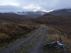
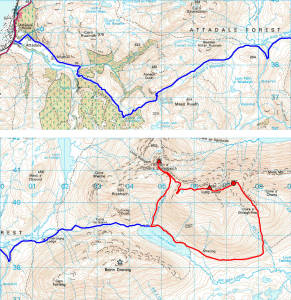
Lurg Mhor is miles from anywhere… except Lurg Mhor! Frequently quoted as one of the very remotest Munros, I’d had it and its neighbour Bidein a’ Choire Sheasgaich on the radar all summer, but what better time to hit such remote peaks than the limited daylight of St Andrew’s Day? So it was up at 4:00am for a 5:00am start, arriving at Attadale on Loch Carron (nearest road access) in time for a wee snooze before it got light enough to start cycling without mounting lights at about 7:50am. And you’ve got ten miles of track just to get to the base of these hills, though it’s questionable whether it’s worth cycling beyond Bendronaig Lodge and Bothy at about eight miles… an extension I’d think slower in and quicker out by bike than walking/running, not to mention apparently discouraged by the car park sign I never read in the morning semi-dark:

Mountain bikes are welcome, however we ask that they be left at Beinn Dronaig Bothy when visitors are climbing the hills beyond.

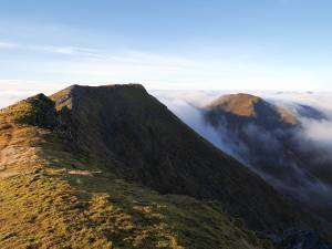
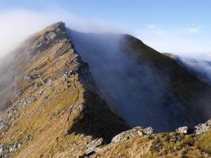
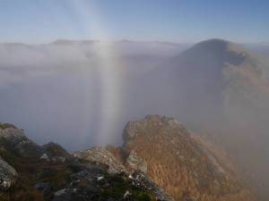
So what can I say about these highly-prized peaks? Lurg Mhor was fantastic, with a more serious feel (greasy, chossy/mossy, care-demanding rock) to the narrow connecting ridge from Meall Mor than you might expect from its nominal Grade 1, but memorable also for the fog bow (at least that’s what I think it was) and one of the most stunning inversions I’ve ever seen (check the ‘inversion’ photo with Bidein a’ Choire Sheasgaich to the left and more distant Coulin Forest and Torridon peaks stretching out right). But then things clouded over completely, I started to get quite cold and wet for a while (one dogleg on the descent to the bealach where I lost the path and tried just following the ‘ridge’ before checking my position properly) and put the camera away on Sheasgaich. Which maybe disappointed slightly on this occasion for such an eagerly-anticipated peak simply because I hardly saw it (well, not at all after Lurg Mhor!), and is now most definitely filed under ‘revisit’. After which things started to brighten up again but not clear completely, and I was back at the bike for a late lunch and quick ride out, rolling down about half the track with the brakes on to hit the road by 3:15pm for a total time of 7 hours 22 minutes including a good hour of stops. And, while I’d seen absolutely nobody on the Fannichs the previous Sunday, I met half a dozen folk on these most interestingly remote hills.

2014-11-30track 2014-11-30bothy

2014-11-30lodge 2014-11-30lochans

2014-11-30stags 2014-11-30lochmonar

2014-11-30inversion 2014-11-30lurgmhorandsheasgaich

2014-11-30lurgmhor 2014-11-30fogbow

2014-11-30map

24 November 2014

Fastpacking Fannichs

Filed under: Running — admin @ 6:34 pm

While not quite the stunning November day of two weeks ago, yesterday’s more wintry trip over the eastern Fannichs brought another healthy haul of four Munros and three Tops. Having done the central group of Meall a’ Chrasgaidh, Sgurr nan Clach Geala and Sgurr nan Each before, finishing the ridge east of those leaves just two Munros and a Top at the western end for another day, but my seven peaks were hard won in conditions that were cold, slippy where frosty/dusted with snow and very windy (nearly got blown off Sgurr Mor!), with generally poor visibility and intermittently showery as well…

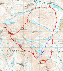
My original plan was to cycle in from Grudie to Fannich Lodge and attack from the south, but even as I got to Garve I was changing to a northerly, non-cycling plan with the extra mile or two on foot trumping a couple of seven-mile cycles with limited daylight available and Sgurr Mor earlier rather than later looking good for a deteriorating forecast. Two obvious bits of lazy nav (see map, 2 and 3) where I set off south from Sgurr Mor and east from An Coileachan (yep, I meant to head north via Meallan Buidhe by the dashed blue track!) without checking the compass, but who’s never done that? Didn’t take me that long to spot the mistake on An Coileachan, but it only took a quick look westwards to put me off trying to contour back round (it’s all rough ground, with a return to the Bealach Ban and something like the dotted blue track apparently the more ‘normal’ way), after which I just kept getting forced east. And that strange little kink high on Beinn Liath Mhor Fannaich (map 1) was caused by starting to follow a path I just had to quit again when it started turning into a bypass!

2014-11-23map

Sorry, no photos, but it just wasn’t that kind of day and I was so keen to keep moving that I didn’t even stop to eat till I was well off my last hill. Might add that the Fastpack 20 was great with the regular UD bottles instead of those soft body bottles I’d too hastily bought from other reviews, with their rigidity not only not affecting real-world (as opposed to living-room-test) comfort but providing much increased security in the right pocket that proved such an effective bottle launcher with the others!

Just 19 Munros, 9 Tops and 6 Deletions to go now, but who’s counting? ;-)

10 November 2014

November Fastpacking

Filed under: Running,Walking — admin @ 7:59 pm

After getting my Ultimate Direction SJ Ultra Vest 2.0 in May and loving it, I was keen to add something similar but larger for the kind of hill days when I needed a greater capacity. But it seemed that it just didn’t exist, with UD’s own PB Adventure Vest only so much bigger and looking marginal for fit with the M/L size topping out at my required 40″ chest and the Salomon packs not appealing so much to me. But then I got wind of the new UD Fastpack 20 (due out September) with M/L size specified for 32″ to 46″ chest and a configuration that looked just right, would have taken it there and then if I could have got my hands on one, and promptly pre-ordered from Castleberg Outdoors. After which the entire UK stock appeared to get held up for a while in customs and I finally got it mid-October, but was unable/unwilling to get out and test it for a while with a spell of atrocious wet weather. So now it’s had a couple of outings (the Devil’s Staircase and Beinn a’ Chrulaiste last weekend for Graham Kelly’s final Corbett and a 20-mile bash round the Coulin Forest peaks yesterday for my Munros/Tops/Deletions quest), what do I think?

Well, it’s good, very good, though I’m not yet convinced by changes to the design of the front pockets. The left pocket is OK, being basically the same as the Ultra Vest pockets, though you do feel the rigid bottles a little more in there and I’m trying the softer Body Bottles just now. But their tapered shape seems less secure in the right pocket (which has a resizing zipper rather than drawcord), with my right bottle getting launched from its pocket several times yesterday on lurching or bending forwards and a similar problem last weekend with my mobile phone escaping the gel/bar pouch there, though it seemed plenty secure enough for cereal bars yesterday. This single pouch does also seem a little stingy when the Ultra Vest has four (two on each side), and there’s unutilised space above the bottle pockets that could have been given to further lidded pouches as done on all the Signature Series vests. That said, everything else is brilliant. I’ve used roll-tops with a single centre clip before on my GoLite packs, but find the new UD arrangement with two side clips much more effective in keeping the roll tidily secure. The vest-style harness is excellent once properly adjusted, giving me an impressively bounce-free carry with the two chest straps well-separated by sliding right up and down and the ability to maintain this for widely differing loads by shortening/lengthening these and the two lower harness straps. On which note I should point out that, like the Ultra Vest, the Fastpack fits ‘smaller’ as you pack it fuller; I could maybe wear the S/M size (24″ to 40″ chest) when lightly packed but guessing I’d run out of adjustment quite quickly when loading it up. The overall shape and capacity is just right, though it took the attached leaflet (or should I say card tags?) and not UD’s site to tell me that the S/M and M/L achieve the same capacity by being slightly different shapes for different torso as well as chest sizes. Current (slight) criticisms of the front pockets apart, the side/back mesh pockets, secure zipped side pocket, ice axe loops, daisy chains etc. all seem excellent and the bottom line is that packs of this (vest) style, capacity and configuration don’t grow on trees; if that’s what you want (as I did), you’ve probably currently got a choice of one and you’re likely to be happy with with it. As I am!

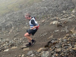
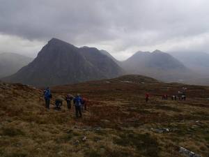
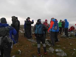
So that’s the Fastpack ‘review’, but what of the trips I’ve been testing it on? Well, Graham managed to pick a surprisingly viable day (Saturday 1 November) for Beinn a’ Chrulaiste, with the incessant rain only really returning for the descent and subsequent evening in the Clachaig (from whence I was kindly driven home by his sister Irene after effectively marooning myself by my morning run over to Altnafeadh to join the ascent party). But, since I haven’t got a photo of the wonderful ‘dram cam’ (whisky bottle with attached, drinker-oriented GoPro) in action, you’ll have to make do with a couple of others instead…
2014-11-01ascent 2014-11-01summit

As for yesterday, that was just a case of taking a gift (a stunning November day after so much poor weather) and getting up early enough (5:10am) to make the most of it. So I’d considered other, shorter, objectives (eg Fionn Bheinn or Moruisg/Sgurr nan Ceannaichean) from my dwindling, North-West cluster of remaining Munros, Tops and Deletions, and kept them up my sleeve as reserves, but just had to go for the long-admired big Corbett of Fuar Tholl and potentially awkward trio of Coulin Forest Munros. Perhaps surprised to meet a fair number of folk on what I’d never thought of as particularly popular peaks, but guessing I’m the only one who did all four! For which I chose the delightfully irregular footwear of Asics Gel Enduros, which aren’t the best on steep grass and moss (not that anything would have been great on all that frosted scree!) but stayed comfortable for my problem feet where I might have taken my Wave Harriers (which got left in the van along with axe and spikes) had I got them half a size larger for thicker, more ‘cold weather’ socks. Would also have liked to add the terrific-looking An Ruadh-stac, but it was never on the agenda with darkness and the Stromeferry Bypass cut-off in mind.

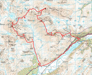
Key to annotated map as follows:

  1. Went too high because the river looked big lower down, but it was still flowing quickly down an awkward mini gorge up here.
  2. Nearly changed my mind about which ridge to climb.
  3. You wouldn’t want to stumble over the Mainreachan Buttress in poor visibility!
  4. While you lose a lot of height down here, the good stalker’s path makes for a better link-up than Irvine Butterfield’s High Mountains suggests.
  5. I took Hidden Gully as per Dan Bailey’s Great Mountain Days in Scotland, but think its right edge (described by Iain Thow in Highland Scrambles North as North Flank, Grade 1/2) probably better when dry.
  6. Took in Meall nan Ceapairean because I got told on the summit of Maol Chean-dearg that it’s a Graham, but wasn’t surprised to discover that it’s not (nothing like enough re-ascent!).
  7. My GPS track is obscuring the rather nice Coire Fionnaraich bothy.
  8. Followed the obvious landrover track in near darkness and missed the short cut to Coulags.
2014-11-09map

And some photos to prove it was all worth it!
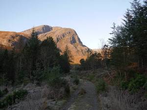
2014-11-09fuartholl1 2014-11-09fuartholl2

2014-11-09mainreachan 2014-11-09lochtorridon

2014-11-09coirelair 2014-11-09liathachandbeinneighe

2014-11-09beinnliathmhor 2014-11-09maolcheandearg1

2014-11-09anruadhstac 2014-11-09maolcheandearg2

28 September 2014

Feshie

Filed under: Running — admin @ 11:02 pm

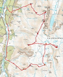
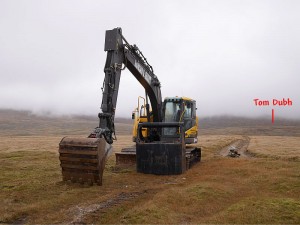
Took a trip to the Glen Feshie Munros on a so-so forecast today with them being the nearest I’d not done (had Carn Ban Mor from ML Assessment years ago, but the rest were ‘new’). And what a strange day it was, with a misjudged start (hindsight saying just take the road and track to the north of my lousy experimental line!) followed by much gently undulating traversing like wandering around in cloudy fields with a high-altitude bulldozer (marked by the flag on the map) providing the most interesting view, but a good finish when I got a hitch up the last wee bit of road after 23 miles on foot. Made a lengthy detour to pick up the insignificant nubble of Tom Dubh (memorably described by Irvine Butterfield as ‘the most meaningless 3000ft ‘top’ in all Britain’!), but Leth-chreag to the south will keep till I go back for my final Cairngorm Munros of Monadh Mor (to which it belongs) and Beinn Bhrotain.

Just 26 Munros, 12 Tops and 7 Deletions left to go out of c.600 peaks that have been in Munro’s Tables, with only 4, 1 and 2 of these respectively south of the Great Glen, so it’s really starting to feel like ‘endgame’ now :-)

2014-09-28map

2014-09-28bulldozer

15 September 2014

Northern Pinnacles

Filed under: Climbing,Running — admin @ 10:25 pm

Meall Dearg and the Northern Pinnacles of Liathach have been calling me ever since I first set eyes on them on a conventional east-west traverse of Liathach 29 years ago. But now I really needed Meall Dearg with the Munro/Top quest not complete without this ‘most difficult top’ (to quote Irvine Butterfield’s somewhat debatable description), so thought I’d go take a look yesterday…

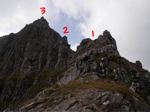
2014-09-14topo 2014-09-14pinnacles

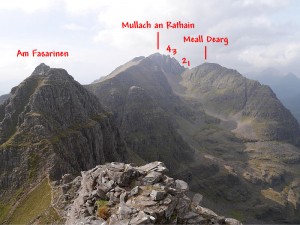
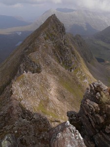
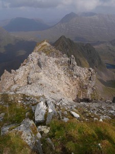
It’s a compelling line, sensibly described by Iain Thow in Highland Scrambles North as ‘a serious and exposed route’ and meriting a climbing grade (Moderate) rather than scrambling equivalent. Iain’s ‘direct’ route starts near the foot of an impressive, but grotty-looking, buttress (extreme right of first photo) rising to the east of Loch Coire na Caime, and here I found his description a little vague in approaching from the Coire Mhic Nobuil/Beinn Eighe path, but think I found the right ‘left-slanting weakness’, which he does warn you is ‘harder than it looks’ and I can only describe to non-connoisseurs of mixed grass, heather, earth and rock as both truly vile and a wee bit scary. But things improve rapidly as the buttress becomes a fine ridge leading to Meall Dearg, though I’d already given myself quite a handicap in getting there by pulling a large block (say 20 x 16 x 5 inches) I shouldn’t have touched off a ledge not far above the vile weakness (note that this route is serious as much for loose/shattered rock at all levels as its significant exposure) and somehow mashed my fingers deflecting it over my shoulder instead of into my chest! And then you have the stunning summit of Meall Dearg, with scant room for the tiniest of cairns and looking quite sensationally steep in retrospect from above, followed by the Northern Pinnacles (which Iain describes very well) themselves with much borderline scrambling/climbing ground culminating in a couple of properly thought-provoking moves up the slab and wall that form the direct finish to the fourth pinnacle. Which now brings you easily to the summit of Mullach an Rathain, with a pleasant west-east traverse of the main ridge (where I’d rate the Fasarinen pinnacles in dry summer conditions as a little easier and certainly less continuously committing than the Aonach Eagach) to take you back to the logical start/finish point at the car park at the foot of the Beinn Eighe path. A superlative day out on the mountain described with at least partial justification by W.A. Poucher as ‘the mightiest and most imposing in all Britain’, with the Northern Pinnacles (being as technical and consequential as much of the Cuillin ridge) just the icing on the cake for those with the requisite experience.
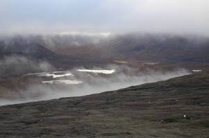
2014-09-14mealldeargfromthirdpinnacle 2014-09-14mealldeargfromtop

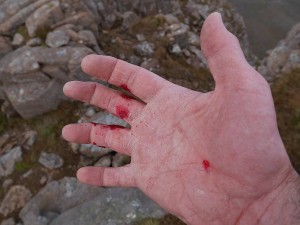
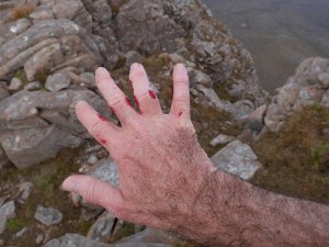
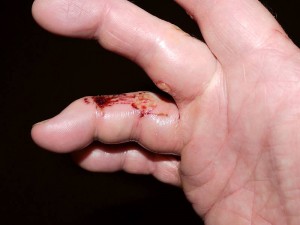
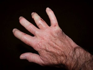
So what of the mashed fingers? Well, they’d become a weeping ball of fire by this morning, with the third finger (which clearly took the brunt of it) now quite puffed up, still weeping, bruising on the other side and unable to bend, but not significantly more crooked/twisted than normal since they all starting getting arthritic a few years back. And, while it didn’t stop me finishing the traverse or driving home from Torridon, I’m not going to pretend it doesn’t hurt!
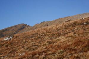
2014-09-14hand1 2014-09-14hand2

2014-09-15hand1 2014-09-15hand2

8 September 2014

Slowest Ben yet!

Filed under: Running — admin @ 7:24 pm

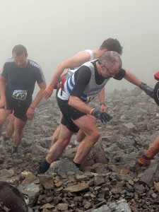
Fair to say I got what I deserved when I’d neither been training ‘for’ it nor been well the preceding week, but afraid my 2013 Ben Race optimism’s now been followed by a new 2014 worst of 2:18:41 and placing outwith the top 200. Which, despite a pretty decent ascent once I’d finally escaped the usual ‘snakes’, was so obviously forged in a descent of such caution I’d have to concede that even 2:05 (let alone that pie-in-the-sky sub-2:00) remains beyond me unless I can learn to run down the thing properly in the next year or two. So there’s now over 11 minutes (rather than under 8) between my best and worst and, while some might argue that’s still ‘consistent’, I think perhaps the writing’s on the wall…

2014 2:18:41
2013 2:07:27
2012 2:11:41
2011 2:15:17
2010 -------
2009 -------
2008 2:08:35
2007 2:12:26
2006 2:08:22
2005 2:10:43
2004 2:13:55

OLYMPUS DIGITAL CAMERA OLYMPUS DIGITAL CAMERA

(With thanks to Noel Williams for the photos!)

« Newer PostsOlder Posts »

Blog powered by WordPress. Feedback to webmaster@petestack.com.