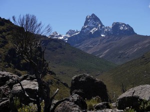
While the tale related here still lacks a clear end (or at least the one it was ‘supposed’ to have), it most definitely began some thirty years ago with my first reading (as a mountain-mad teenager) of No Picnic on Mount Kenya, Felice Benuzzi’s thrilling tale of his audacious wartime attempt on that great peak:
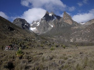
I emerged at last, stumbled a few steps in the mud and then I saw it: an ethereal mountain emerging from a tossing sea of clouds framed between two dark barracks — a massive blue-black tooth of sheer rock inlaid with azure glaciers, austere yet floating fairy-like on the near horizon. It was the first 17,000-foot peak I had ever seen.
I stood gazing until the vision disappeared among the shifting cloud banks.
For hours afterwards I remained spell-bound.
I had definitely fallen in love.
So I too was hooked, and that, despite my more distant view (informed only by words and pictures!), was the start of my own Mount Kenya affair, with the dream slow to take more tangible shape till Angus upped the ante by sending me a guidebook and I subsequently emailed him to say:
Let’s do it! Rainier + a.n.other(s) in 2006 and Mount Kenya in 2008?
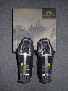
Now, for one reason or another (mostly training for three West Highland Way Races in 2007, 10 and 11 as well as my Winter ML assessment in 2011), that timescale for Kenya slipped a bit, but it remained firmly on the agenda (no way did I want to be looking back in old age saying ‘we should have done that’!) and we finally booked a package with EWP (run by a friend of a friend) for Christmas 2011 to take us from Nairobi to the mountain and provide us with porter/cook support while leaving us free to do our own climbing. And then, after much careful planning and rationalisation of gear (helped by convivial discussions with Mike Pescod and Chris Vind, who’ve both been there several times), we were actually on our way.
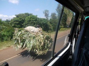
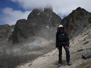
Arriving at Nairobi on Christmas Eve, we were met by Kingston and Dickson (‘Mike Pescod is my friend so you are my friend’!) before driving on roads good, bad and unfinished (all typically shared with overladen pushbike, motorbike and donkey cart) to Chogoria in the ubiquitous Toyota Hiace (surely Kenya’s most common vehicle!) to pick up Alfred (our cook and de facto guide), Douglas, Festus, Ken, Kenneth, Jack and Jackson, who’d all be working as our porters. And then we set off for the Chogoria Bandas (huts) with eleven of us (a new driver taking Dickson’s place) bouncing up a severely eroded, rutted and apparently interminable track in an old Landrover before Angus and I finally got dropped off with two of the crew to enjoy a walk up the last bit! Have to say I was surprised by dinner, with one crucial piece of information (‘SPECIAL NOTES – NO SEAFOOD OR FISH FOR PETER’) apparently not getting through from EWP, but a pretty comfortable night (buffalo banging against the huts!) at nearly 3,000m was followed by our first distant sighting of the twin peaks of Batian (5,199m) and Nelion (5,188m), with a bonus elephant to boot.
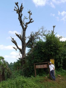
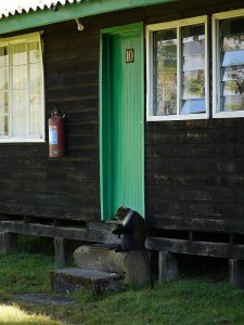
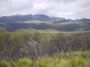
Now, Mount Kenya’s notorious for its significant incidence of AMS or Acute Mountain Sickness, with excessive haste fuelled by underestimation (when it’s neither particularly high nor difficult in global terms) probably the principal cause, so our walk-in was carefully planned to give us the best chance by proceeding ‘pole-pole’ (essential Swahili for visitors!) up and down over five days, with camps at Nithi (3,300m), Lake Michaelson (c.3,950m), Simba Tarn (c.4,600m) and the Austrian Hut (4,790m). But I was plagued even so by blocked noses and headaches resulting from those long, stuffy, twelve-hour nights lying in the tent (the temperature dropping quickly enough to drive us in at dusk most evenings) and we saw ample evidence of misjudgement and/or bad luck on meeting others retreating from tighter schedules with hacking coughs.
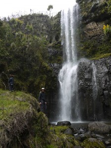
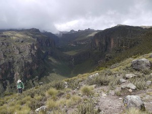
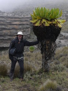
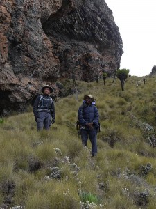
Trying to convey the wonders of that walk-in through a handful of two-dimensional words and photos is quite frankly impossible, but who could forget that Christmas trip to the Nithi caves and waterfall, the spectacular setting of Lake Michaelson nestling in the floor of its stupendous gorge (try to imagine yourself looking back from high up the ‘gorges’ photo in real-life 3D!), or scenery and vegetation that swung between the surprisingly familiar (look down here and you could be in Scotland) and the totally new (look over there and you most certainly couldn’t!)? Not to mention both ‘Scottish’ weather (mist, rain and then snow at Simba Tarn, with few sights of our peaks for the first few days) and ‘Kenyan’ (blue sky and sunshine of course!), with ‘cultural’ discussions where (prompted by questions about what we made of it all and how things compared to home) I maybe took on the impossible in attempting to express my mixed feelings of excitement at being there, guilt at being the ‘rich white man’ abroad (numerous pushy selling/trading/begging episodes at roadside stops having already left me feeling very ‘white’!) and hope that our presence was nevertheless bringing our companions profitable employment.
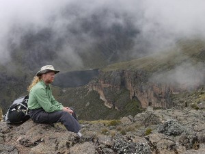
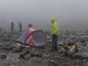
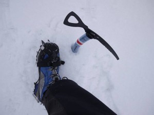
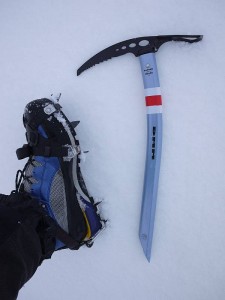
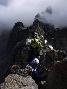
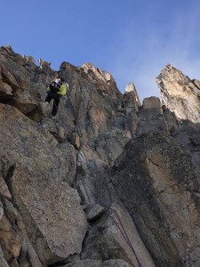
So here we were at the Austrian Hut on this very windy Wednesday, with Point Lenana (Mount Kenya’s third peak at 4,985m, and magnet for excited trekkers) bagged in the morning (no, I never touched the steel cable and five or six steps now fixed to the rocks!), two of our porters on their way home with the load lightening every day, a solitary guide/client pair successfully negotiating the Normal Route on Nelion (which we hoped to complete as Shipton and Tilman did by crossing the Gate of the Mists to Batian) and another party making much slower progress before finally retreating after apparently losing time off-route. While our schedule did allow for a practice climb up Point John (or similar) or further acclimatisation day, we’d pretty well agreed to go straight for the big one if conditions (both health and weather) permitted, and that’s what we did… but with the unplanned twist of our late decision to dump the sleeping bags, stove and cookable food (effectively ruling out a planned bivy by taking just bivy bags and duvet jackets). Leaving camp at 5:00am Thursday (my nose gushing blood as I tried to blow it clear!) to cross the Lewis Glacier and tackle the awkward initial scree slopes by dark, we then had to wait (not that long) for the two guided ropes of three led by Felix and Duncan ahead of us to get started, finally hitting the rock as it caught the rising sun at about 6:30am. So we were right with them for the first two (Grade 1) pitches, and here I was thinking they’d be slower (as threes) up the more technical stuff and we’d be able to follow them the whole way, but of course I was underestimating the guides’ slickness on a route they both knew and we were soon back alone completing the trickier traverse (with awkward, airy move to reach the base of Mackinder’s Chimney) to the rib (Grade III or IV, depending on guide) right of the Rabbit Hole. And here I messed up by straying right of the ‘easy rocks’ at the top, landing myself in a properly scary (‘trouser-filling’) position as I pigheadedly pulled over a steep bulge capped by a loose block before more sensibly instructing Angus to remove my runner (some distance below) and step back left. With this (mainly self-induced) ‘mauvais pas’ vanquished, it was easy climbing (few runners needed) for several pitches up One O’Clock Gully (II) and the slabs (I) to the crossing of the ridge at Baillie’s Bivy, but time was somehow disappearing at an alarming rate and (see the building problems here?) we were neglecting to eat or drink as we pushed to keep moving at the necessary speed…
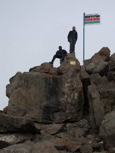
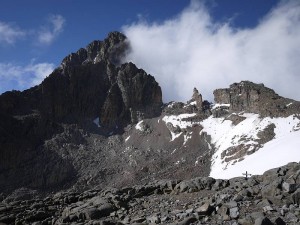
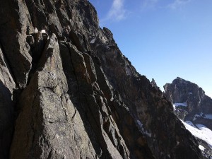
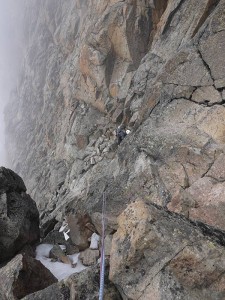
Having said something earlier about ‘much careful planning’ (possibly already wasted after dumping the bivy gear and bumbling on up!), perhaps I might add that I’d bought all three printed climbing guides and made up a laminated sheet with their Normal Route descriptions and diagrams. But here perhaps too much information proved counterproductive with the mist closing in and the descriptions simply confusing things by disagreeing just when we needed their help most. So we had Cameron Burns telling us to ‘descend about 25 meters onto rock ledges above the Upper Darwin Glacier’ where Iain Allan said ‘turn the Gendarme on the left by first descending 7 to 10 m and then up a large gully’ and the EWP map/guide ‘descend 3m, then up on easy ground (sometimes icy) to the base of a wall.’ Which meant yet more time lost in poor visibility while I tried this way and that, only deducing later that Burns must be describing the original way by Shipton’s and Rickety Cracks (with the ’25 meters’ still only making sense as a descending traverse?) and not De Graaf’s Variation, which is given by the others as the Grade IV crux and may be the ‘easiest, most direct route’, but remains quite a tough cookie at that (think Severe pitch feeling more like VS at over 5,000m). From which you might guess that we did eventually locate it (my assessment of some meaty moves on smallish holds with good rest points and gear being in stark contrast to that of a cold, tired Angus, who had a desperate struggle to follow), but that really was the beginning of the end with ambition, realism, hope, common sense and goodness knows what else all battling in mental (mortal?) conflict and another easy pitch up the ridge above taking us to what we conceded to be our high point of just over 5,100m…
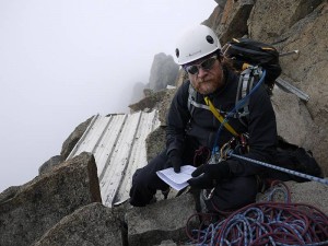
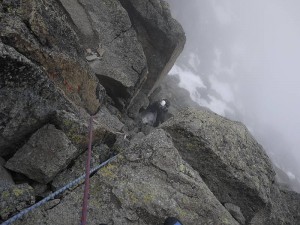
So it was mid-afternoon, we’d done the crux and, with ‘just’ a couple of short Grade III sections (the first an ‘unobvious traverse’) and some Grade I ground between us and the summit of Nelion, I’ve little doubt that we’d have got there (and probably even over to Batian) by nightfall. But we were cold, tired, hungry, thirsty (nay, I was raw from drinking nothing while puffing away at altitude!) and, with no sleeping bags or stove, needing to get down. While it was still sorely tempting to press on, we’d be committing to (at best) the bivy from hell followed by a tricky descent in even (probably much!) colder, tireder, hungrier, thirstier shape and (at worst)… well, who knows? We’d just spotted the two (successful) guided ropes abseiling back towards us, were aware that a couple of the bolted abseil points might be tricky to find, could see the logic in following a group who knew them all, and that was that. It was a no-brainer (simultaneous, ‘telepathic’ agreement) and we were going down!
Now, we might have been slower than the guided parties climbing up, but they had six to get down (one of them injured after somehow swinging into the rock) where we were just two, and much waiting (as well as considering how we could help) ensued before we thankfully accepted Duncan’s invitation to share ropes and speed things up for all eight of us. So Felix took our ropes and theirs to fix multiple abseils for everyone, with Duncan and us bringing up the rear to strip the abs as we followed the others down (strangely our second ‘joint’ big mountain descent after previously sharing ropes with an RMI party on Mount Rainier). The sun was back out (quite a tease despite our very sound decision!) but the abs were purgatory (it’s a long way down but we must have gained all that height on the climb!), with some being overhanging and even conspicuously free (Duncan admitting to hating that one) and me now tired enough to be needing mid-rope rests (you might not equate sliding down a rope with effort, but everything’s so bloody tiring at altitude!). With it getting dark as we came off the face, we still faced a ghastly descent down that blocky scree to the Lewis Glacier, one of the weariest trudges of my life back up to our camp at the hut and a night so cold that I still shiver at the thought of the bivy we’d escaped, but we’d given it everything and, despite some natural disappointment when the day had started so full of hope and expectation, been respectably (truly!) high on the mountain. For sure we’d made mistakes (probably starting with ditching the bivy gear in the hope of climbing quicker) and been too slow (for which we could blame everything from misty route-finding dilemmas and confusingly contradictory guides through time-consuming over-engineering of belays to simple inexperience of covering that kind of ground at altitude with the speed required for success), but lessons were learned, I’d get to the same place in half the time now and it doesn’t have to (isn’t going to!) be the once-in-a-lifetime shot I’d first imagined.
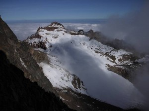
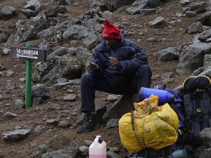
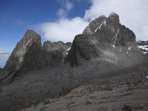
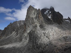
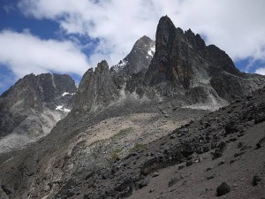
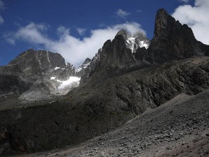
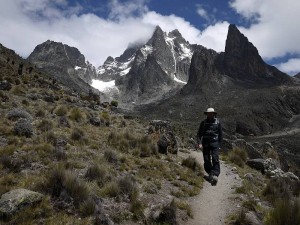
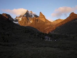
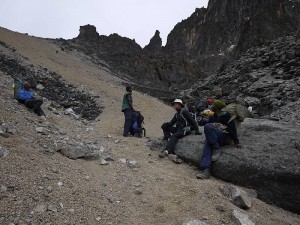
As for our next moves when we could maybe have given it another go, we’d tried to make a ‘flexible’ arrangement (pending outcome of the climb) for a few days’ safari but, with no easy way of rearranging that from the mountain, felt effectively committed by our booking and might even admit to craving the change as the mounting days at altitude took their toll. So, despite mixed emotions on abandoning our coveted peaks to others (with both Nelion and Batian climbed during the clear days of our descent), we’d had enough, needed to get down for some air and were happy just to complete the circular tour by way of easy days to Mackinder’s and Shipton’s Camps at c.4,200m before leaving via the Sirimon Route. And here at least (or last?) we were rewarded with the most spectacular views, with the descent to Mackinder’s disclosing a staggering series of new angles on those now familiar peaks and spires before settling down to the ‘classic’ view of Batian and Nelion split by the Diamond Couloir and Glacier, Shipton’s (where I set my personal altitude record for appalling piccolo playing!) notable for both the attractive prospect of Terere and Sendeyo (something of a cross between Stac Pollaidh and Suilven?) and sterner north side of Batian, and the Sirimon walk-out on New Year’s Day the stunning vision (eagerly anticipated from Chris Vind’s slides) of Batian as the great icy fang you might imagine from Felice Benuzzi’s description. So I’ve uploaded a fair sequence of photos to show some of these striking scenes, but had better also explain the ‘seaweed’ one as being named for the lichenous rock so prevalent on the climb over the Hausberg Col to Shipton’s Camp and conjuring up the strange vision of some cosmic low tide on a 4,500m seashore!
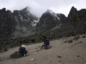
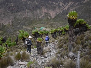
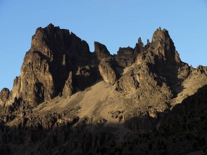
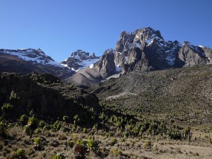
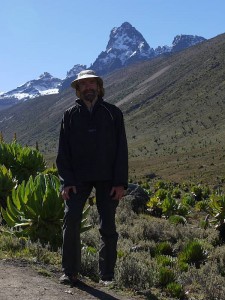
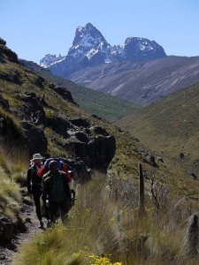
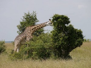
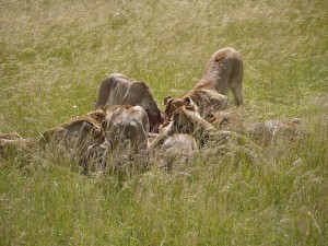
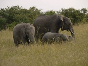
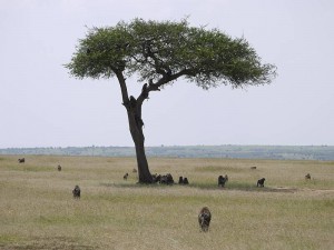
And so to the safari I’d formerly only been able to see following a successful ascent, with a further night’s camp at Old Moses (3,300m) taking us to the Sirimon Gate and another rendezvous with Dickson and his Hiace leading (via a night at Naru Moru River Lodge, where we found attractive grounds but no hot water!) to many never-ending drives on disintegrating roads in another Hiace (what else?) with Francis and Alfred, who stayed with us as cook for the whole trip. Had we guessed that ‘camping’ safari meant a night (at Lake Nakuru) in what I’d call a holiday cottage followed by two (in the Maasai Mara) in a canvas bungalow with real beds, tables and chairs, plumbed loo, basin and shower when we’d expected a simple tent like the well-used Gelert we’d just spent eight nights in, perhaps we’d have skipped the Lodge, but you live and learn! To sum up our safari sightings, we scored a clean sweep of the ‘big five’ (buffalo, rhino, lion, elephant and that elusive leopard up a tree), with huge supporting cast of (in no particular order) baboons, monkeys, hyraxes, zebras, giraffes, hippos, warthogs, hyenas and ostriches, so many types of antelopes (including my naturally favourite impala) and birds (yes, I know the ostrich is a bird!), solitary crocodile, cheetah, jackal and something-or-other-cat that Francis excitedly pronounced very rare, and probably loads more I’m simply forgetting right now. But the grisly highlight has to be the pride of lions stalking the herd of topi, giving chase (we thought the lioness had gone too soon but she knew best!), bringing one down and noisily devouring it… a genuinely exciting sight when it’s ‘live’ (as in happening before your eyes) and the outcome unknown! So the safari was good (with Francis an impressively knowledgeable and enthusiastic guide), I’m glad we did it and happy to have brought the memories home, but must also say I’ll not be rushing to repeat the hundreds of boneshaking, dusty miles involved in getting there and back (so surely a prime national asset like the Maasai Mara deserves better than that hellish ‘road’?) and couldn’t stand many more mosquito bites (something that never troubled us during our ten days on the mountain but proved to be something of a holiday ‘sting in the tail’).
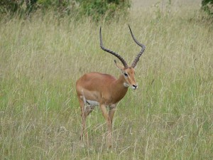
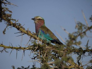
While we’d been eagerly anticipating our final-evening meal at Nairobi’s famous Carnivore restaurant, I’d ultimately have to class this ‘good’ rather than ‘great’, with Kenya’s 2004 ban on the sale of the game meat that used to be its raison d’être being largely to blame and the lack of anything more exotic than crocodile or ostrich (where the Burns guide had specified ‘zebra, crocodile, waterbuck, hartebeest, giraffe, and various gazelles’) being disappointing despite the attractive ambience and excellent cooking of more domestic fare. But perhaps my real gripe here is with Burns’s book when he should have got that right for the 2006 edition and we’d already found it (despite its usefully wider scope) to be consistently outclassed by the Allan guide on the mountain, with the latter’s ‘definitive’ coverage of routes and variations (note the scarily different assessment of the South Face Route!), better geological information (so where’s the nepheline-syenite in Burns?) and fascinating section on place names just some of the reasons we preferred it up there. To which I might add that I’d still suggest getting both (along with the EWP map/guide) for their different content, but cross-checking carefully where we learned the hard way from the ‘De Graaf affair’, and maybe (just maybe!) treating the East African/UK grade comparisons with a pinch of salt where our route surely warrants a good Severe at IV- instead of the V Diff/Mild Severe they give for IV!
So that’s our Kenya trip in a prosaic nutshell, and I’ve been wrestling for days with the words and photos (choosing the ‘right’ ones from 802 proving almost as tortuous as the writing!) to commit even this shadow to type. But so much of interest and importance remains unsaid, with what I’d envisaged as a glorious conclusion to my dream now looking more like just the first ‘act’ and strong connections to the place and people joining the mountain as reasons to return. No doubt that Batian’s still the big draw (still my ‘magic’, no.1, most wanted world peak!) and I must unlock the Gate of the Mists before this affair can ever be considered over, but there’s so much to explore with Mount Kenya no more a single peak than the North Face of Ben Nevis just a wall, and I’ll be hoping to see some familiar faces when I do. So perhaps I’ll be booking Dickson to do some climbing (when he’s happy to share the lead and I could get excited about heading up there with someone who knows the mountain like he does!) or perhaps I’ll be returning with Angus (hmmm, when?) and/or others, but whatever happens I simply must save the last word just now for Alfred, who worked tirelessly for us the whole fortnight as cook (such good food!), guide and friend, and wish the Mugendi family great joy with the baby daughter born on our final day in Kenya.
Asante sana, Alfred, and here’s to the next time! :-)
